-
Use Cases
-
Resources
-
Pricing
Canals are artificial waterways built for navigation, irrigation, or water supply. Their history spans thousands of years, from ancient Mesopotamian and Egyptian irrigation canals to monumental modern engineering projects like the Suez Canal (1869), Panama Canal (1914), and China's Grand Canal, the longest in the world. Canals transformed trade, transportation, agriculture, and industrial development across civilizations. More Less
800 BC - 500 BC
From the Spring and Autumn period (8th–5th centuries BCE) onward, the canals of China were used for army transportation and supply, allowing rulers to move troops and provisions efficiently across their territories.
Image source: History of canals in China
800 BC - 500 BC
During the Spring and Autumn period, China's canals also served as a tool for the colonization of new territories, enabling settlement and expansion into previously less accessible regions.
600 BC
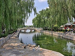
While earlier estimates varied, modern scholars now usually place the construction of key Chinese canal works, including early sections of the Grand Canal, in the 6th century BCE.
Image source: Grand Canal (China)
300 BC
Beginning with the Qin dynasty in the 3rd century BCE, China's canal network became essential to imperial taxation-in-kind, allowing grain collected as tax to be transported to the capital.
1022 - 1063
Under the Northern Song Emperor Renzong, whose reign spanned 1022 to 1063, the amount of grain transported via the country's waterways increased to 80 million bushels per year.
1368
In 1368, the first year of the reign of the Ming Hongwu Emperor, the Capital Grain Transport Office was established under the auspices of a fourth grade commissioner, formalizing administration of grain transport.
1368 - 1644
During the Ming Dynasty, the volume of the grain tax transported via the Grand Canal far exceeded that of the preceding Yuan Dynasty, reflecting the canal's renewed centrality to state finance.
1415 - 1800
The situation of canal-based grain taxation remained virtually unchanged until the beginning of the 19th century, when growing pressures began to prompt reforms in how tribute grain was shipped.
1415
From 1415 onwards, imperial regulations stated that the grain taxation system should use only the country's canal network, redirecting the entire grain tax onto inland waterways.
1415
Following the 1415 regulations requiring canal-only transport of the grain tax, all seaborne transportation of tribute grain ceased, ending an earlier era of coastal grain shipping.
1644 - 1911
During the Qing Dynasty as well, the volume of grain tax moved along the Grand Canal far exceeded that carried under the preceding Yuan Dynasty, sustaining the pattern begun under the Ming.
1644 - 1912
From the Qin (3rd century BCE) to the Qing (17th–20th centuries CE), China's canal network remained essential to imperial taxation-in-kind, serving as the backbone of grain transport for over two millennia.
1825
In 1825 during the reign of the Daoguang Emperor, a maritime shipping office was established in Shanghai, marking a revival of sea transport for the grain tax alongside the aging canal network.
1825
As part of the 1825 reforms under the Daoguang Emperor, a grain tax receiving station was set up at Tianjin, providing a northern terminus for maritime shipments of tribute grain.
1839 - 1842
Before the First Opium War of 1839–42, yearly grain-tax maritime shipments had reached around 4 million bushels of grain per annum, demonstrating the scale of revived seaborne transport.
1856 - 1860
Before and during the Second Opium War (1856–60), yearly grain-tax maritime shipments continued at around 4 million bushels per annum even as the canal system came under strain.
Jul 21, 1842
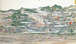
On July 21, 1842, during the later stages of the First Opium War, British troops attacked and occupied Zhenjiang near the confluence of the Grand Canal and Yangtze River, effectively blocking operation of the canal system and its grain taxes.
Image source: Battle of Chinkiang
1850 - 1864
The Taiping Rebellion of 1850–64 devastated much of central China, resulting in the loss of Nanjing and key segments of the Yangtze River corridor vital to the canal network.
1851 - 1855
After the Yellow River changed course in its floods between 1851 and 1855, the hydrology of eastern China was dramatically altered, with severe consequences for the canal network crossing its path.
1851
Following the Yellow River's course change in its 1851–1855 floods, the canals in the Shandong region gradually silted up, rendering long stretches of the Grand Canal impassable.
1853 - 1863
From 1853 onwards, the Anhui segment of the Yangtze River was lost for ten years due to the Taiping Rebellion, thereby curtailing operation of the connected canal network.
1853
With the fall of Nanjing to rebel forces in 1853, the city was lost to the Qing government for ten years, severely curtailing traffic on the adjacent canal and river routes.
Image source: Taiping Rebellion
1872
In 1872, an office to promote investment in steamships was established in Shanghai when steamships became the official vessels used within the grain-tax system, further sidelining canal transport.
1901
In 1901, all canal-based traffic of the grain tax ceased, formally ending the Grand Canal's centuries-long role as the artery of imperial taxation-in-kind.
1911
In 1911 the Jinpu railway opened, linking Tianjin and Zhenjiang, such that the importance of the Grand Canal and the towns along its banks significantly dropped as rail took over transport.
Image source: Jinpu railway station
1965
Completed in 1965, the Red Flag Canal's main channel is 71 kilometers (44 mi) long, winding around the side of a cliff and through 42 tunnels, an extraordinary feat of manual labor in Linzhou, Henan.
Image source: Red Flag Canal
1965
Following its completion, the Red Flag Canal was celebrated within China as a symbol of collective determination and engineering achievement achieved largely by hand.
1972
The Red Flag Canal was the subject of several movies, including a section of Michelangelo Antonioni's 1972 documentary Chung Kuo, which brought the canal to international audiences.
Image source: Chung Kuo, Cina
2002
China's South–North Water Transfer Project, one of the largest infrastructure undertakings in history, began construction to channel water from the south of the country to the arid north via new canal routes.
Image source: South–North Water Transfer Project
2014
The South–North Water Transfer Project is still ongoing, but its central route was completed in 2014, delivering water hundreds of kilometers north to Beijing and surrounding regions.
Or browse the full history timeline directory, with more than 2,500 topics.
This History of Canals timeline was generated with the help of AI, using information found on the internet.
We work hard to keep these timelines accurate, but mistakes do get through. If you spot one, email us at [email protected] and we'll fix it for future visitors.
Generate yours with AI or build it from scratch, for free.
Export your timeline, add your own events, edit or remove AI-generated events, and much more
No credit card required.
Cancel anytime.
Cancel anytime.
You can create an unlimited number of timelines with up to 10 events on each one, customize how they look, export them to PDF, PNG, PowerPoint, CSV, and Excel, and share them with a link. Paid plans raise the event limit and add features like spreadsheet imports and collaborators.
Yes. You can cancel your subscription from your account page at any time, and you will not be charged again. Your subscription stays active for the rest of the period you already paid for.
Yes. We will email you a reminder before the annual renewal, and we will also email you a receipt.
Yes. You can email us within 15 days of any payment, and we will issue you a full refund.
Check out our pricing docs or send us an email anytime: [email protected].