-
Use Cases
-
Resources
-
Pricing
The history of geology traces humanity's evolving understanding of the Earth's structure, materials, and processes. Beginning with ancient observations of rocks, minerals, and fossils, the discipline developed through the Renaissance with figures like Nicolas Steno, matured during the 18th and 19th centuries through debates between Neptunists and Plutonists and the work of James Hutton and Charles Lyell, and was revolutionized in the 20th century by Alfred Wegener's continental drift theory and the acceptance of plate tectonics. More Less
1000
% complete
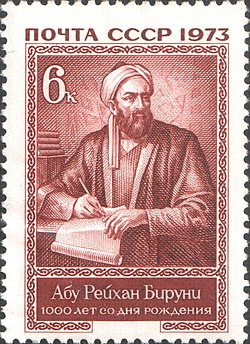
Abu al-Rayhan al-Biruni (AD 973–1048) was one of the earliest Muslim geologists, whose works included the earliest writings on the geology of India, hypothesizing that the Indian subcontinent was once a sea.
Image source: Al-Biruni
1020
% complete
Ibn Sina (Avicenna, AD 981–1037), a Persian polymath, made significant contributions to geology and the natural sciences, which he called Attabieyat, along with other natural philosophers such as Ikhwan Al-Safa.
Image source: Avicenna
1060
% complete
In medieval China, Shen Kuo (1031–1095) was one of the most intriguing naturalists, a polymath personality who dabbled in many fields of study in his age, including observations relevant to geology.
Image source: Shen Kuo

1600 - 1699
% complete
It was not until the 17th century that geology made great strides in its development, driven by both religious and scientific speculation about the origin of the Earth.
Image source: History of geology
1650 - 1700
% complete
During the 17th century, both religious and scientific speculation about the Earth's origin further propelled interest in the Earth and brought about more systematic identification techniques of the Earth's strata.
Image source: Stratigraphy
1659
% complete
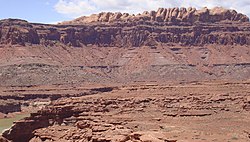
Nicolas Steno was trained in classical texts on science; however, by 1659 he seriously questioned accepted knowledge of the natural world, beginning investigations that would transform the study of strata.
Image source: Nicolas Steno

1660
% complete
Steno's investigations and subsequent conclusions led scholars to consider him one of the founders of modern stratigraphy and geology. He became a Catholic as an adult, was eventually made a bishop, and was beatified in 1988 by Pope John Paul II.
1687
% complete
In 1687, in his Principia, Isaac Newton was the first to calculate the age of Earth by experiment, based on a globe of iron cooling equal to Earth in size, arriving at an estimate of 50,000 years old.
Image source: Isaac Newton
1696
% complete
Due to the strength of Christian beliefs during the 17th century, the most widely accepted theory of the Earth's origin was A New Theory of the Earth, published in 1696 by William Whiston.
Image source: William Whiston
1741
% complete
In 1741 the best-known institution in the field of natural history, the National Museum of Natural History in France, created the first teaching position designated specifically for geology.
Image source: National Museum of Natural History, France
1749
% complete
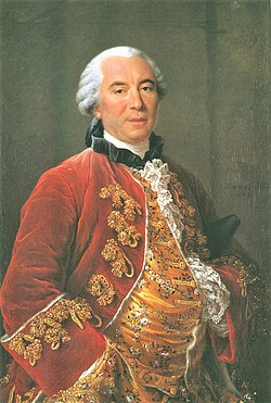
In 1749, the French naturalist Georges-Louis Leclerc, Comte de Buffon published his Histoire Naturelle, in which he attacked the popular Biblical accounts given by Whiston and other ecclesiastical theorists of the history of the Earth.
Image source: Georges-Louis Leclerc, Comte de Buffon
1750
% complete
Abbé Anton Moro, who had studied volcanic islands, first proposed the theory that strata had been formed through heat or fire before 1750; James Hutton subsequently developed it as part of his Theory of the Earth.
Image source: Anton Moro
1750 - 1800
% complete
The increasing economic importance of mining in Europe during the mid to late 18th century made the possession of accurate knowledge about ores and their natural distribution vital.
1750
% complete
From the works of respected thinkers such as Buffon and Kant, as well as others, it became acceptable by the mid eighteenth century to question the age of the Earth.
Image source: Age of Earth
1751
% complete
The term 'geology' was first used technically by Genevan naturalists Jean-André Deluc and Horace-Bénédict de Saussure, but it was not well received until taken up in the influential Encyclopédie, published beginning in 1751 by Denis Diderot.
Image source: Encyclopédie
1755
% complete
Immanuel Kant described the history of the Earth with reference to neither God nor the Bible, publishing his Universal Natural History and Theory of the Heavens in 1755.
Image source: Universal Natural History and Theory of the Heavens
1774
% complete
In 1774 Abraham Gottlob Werner published Von den äusserlichen Kennzeichen der Fossilien, which brought him widespread recognition because he presented a detailed system for identifying specific minerals based on external characteristics.
Image source: Abraham Gottlob Werner
1780 - 1800
% complete
The Neptunist thesis, extending chemical theories developed since the seventeenth century and promoted by John Walker, Johan Gottschalk Wallerius and Abraham Werner, was the most popular during the late eighteenth century, especially among the chemically trained. Werner's views became internationally influential around 1800.
1790 - 1815
% complete
Starting in the 1790s, mining surveyor William Smith found empirically that fossils were highly effective means of distinguishing between otherwise similar formations as he worked on England's canal system, producing the first geological map of Britain.
Image source: William Smith (geologist)
1800 - 1900
% complete
During the 19th century several countries, including Canada, Australia, Great Britain and the United States, initiated geological surveying that produced geological maps of vast areas of the countries.
Image source: Geological survey
1800 - 1850
% complete
Followers of this thesis during the early nineteenth century referred to Plutonism: the formation of the Earth through the gradual solidification of a molten mass at a slow rate by the same processes that had occurred throughout history and continued in the present day.
Image source: Plutonism
1811
% complete
After the publication of Cuvier and Brongniart's book 'Description Geologiques des Environs de Paris' in 1811, which outlined the concept, stratigraphy became very popular amongst geologists, many of whom hoped to apply it to all the rocks of the Earth.
Image source: Georges Cuvier
1820 - 1840
% complete
In early nineteenth-century Britain, catastrophism was adapted with the aim of reconciling geological science with religious traditions of the biblical Great Flood.
Image source: Catastrophism
1830
% complete
Charles Lyell challenged catastrophism with the publication in 1830 of the first volume of Principles of Geology, presenting geological evidence from England, France, Italy and Spain to prove Hutton's ideas of gradualism correct.
Image source: Principles of Geology
Dec 27, 1831
% complete
In 1831 Captain Robert FitzRoy, given charge of the coastal survey expedition of HMS Beagle, sought a suitable naturalist to examine the land and give geological advice, selecting Charles Darwin.
Image source: HMS Beagle
1833
% complete
In 1833 Adam Sedgwick mapped Cambrian rocks while Charles Lyell suggested a subdivision of the Tertiary Period, and Roderick Murchison assigned upper parts of Sedgwick's Cambrian to his own Silurian Period, further refining the stratigraphic column.
Image source: Adam Sedgwick
1842
% complete
Darwin's subsidence theory of coral reef formation was confirmed when the Beagle surveyed the Cocos (Keeling) Islands, and in 1842 he published The Structure and Distribution of Coral Reefs.
Image source: The Structure and Distribution of Coral Reefs
Nov 24, 1859
% complete
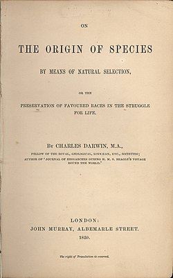
Darwin's discovery of giant fossils helped establish his reputation as a geologist, and his theorising about the causes of their extinction led to his theory of evolution by natural selection, published in On the Origin of Species in 1859.
Image source: On the Origin of Species
1862
% complete
In 1862, physicist William Thomson, 1st Baron Kelvin, published calculations fixing the age of the Earth at between 20 million and 400 million years, based on cooling models of the planet.
Image source: Lord Kelvin
1911
% complete
In 1911 Arthur Holmes, among the pioneers in using radioactive decay to measure geological time, dated a sample from Ceylon at 1.6 billion years old using lead isotopes.
Image source: Arthur Holmes
1912
% complete
In 1912 Alfred Wegener proposed the theory of continental drift, suggesting that continents had once been joined together and had since moved apart across the surface of the Earth.
Image source: Continental drift
1913
% complete
In 1913, while on the staff of Imperial College, Arthur Holmes published The Age of the Earth, arguing strongly for radiometric dating methods rather than methods based on sedimentation or cooling of the Earth, against Kelvin's estimates of less than 100 million years.
1921
% complete
In 1921, attendees at the yearly meeting of the British Association for the Advancement of Science reached a rough consensus that the age of the Earth was a few billion years and that radiometric dating was credible.
1927 - 1947
% complete
Holmes published The Age of the Earth, an Introduction to Geological Ideas in 1927, presenting a range of 1.6 to 3.0 billion years, increasing the estimate in the 1940s to 4,500 ± 100 million years based on measurements of uranium isotope abundance established by Alfred O. Nier.
1947 - 1960
% complete
Beginning in 1947 research provided new evidence about the ocean floor, and by 1960 Bruce C. Heezen and Marie Tharp's work on mid-ocean ridges laid crucial groundwork for the acceptance of plate tectonics.
Image source: Plate tectonics
1965
% complete
A symposium on continental drift held at the Royal Society of London in 1965 must be regarded as the official start of the acceptance of plate tectonics by the scientific community; its abstracts were issued as Blacket, Bullard, Runcorn, 1965.
1972
% complete
In 1972, The Landsat Program, a series of satellite missions jointly managed by NASA and the U.S. Geological Survey, began providing satellite imagery that transformed the perspective of geological study in the later 20th century.
Image source: Landsat program
Or browse the full history timeline directory, with more than 2,000 topics.
This History of Geology timeline was generated with the help of AI, using information found on the internet.
We work hard to keep these timelines accurate, but mistakes do get through. If you spot one, email us at [email protected] and we'll fix it for future visitors.
Generate yours with AI or build it from scratch, for free.
Export your timeline, add your own events, edit or remove AI-generated events, and much more
No credit card required.
Cancel anytime.
Cancel anytime.
You can create an unlimited number of timelines with up to 10 events on each one, customize how they look, export them to PDF, PNG, PowerPoint, CSV, and Excel, and share them with a link. Paid plans raise the event limit and add features like spreadsheet imports and collaborators.
Yes. You can cancel your subscription from your account page at any time, and you will not be charged again. Your subscription stays active for the rest of the period you already paid for.
Yes. We will email you a reminder before the annual renewal, and we will also email you a receipt.
Yes. You can email us within 15 days of any payment, and we will issue you a full refund.
Check out our pricing docs or send us an email anytime: [email protected].