-
Use Cases
-
Resources
-
Pricing
The history of oceanography traces humanity's study of the oceans from ancient navigation and charting by early civilizations, through the pioneering HMS Challenger expedition of 1872–1876 that established oceanography as a modern science, to today's advanced technologies including sonar, submersibles, satellites, and autonomous vehicles that continue to reveal the secrets of the deep sea. More Less
1427
% complete
The 'rediscovery' of the Azores islands in 1427 reflected the heightened strategic importance of the islands, now sitting on the return route from the western coast of Africa, known as the 'volta de Guiné' and later 'volta da Mina'.
Image source: Oceanography
1436
% complete
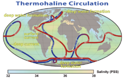
References to the Sargasso Sea (also called at the time 'Mar da Baga'), to the west of the Azores, in 1436 revealed the western extent of the Portuguese return route across the Atlantic.
1454 - 1486
% complete
There were systematic expeditions pushing into the western Northern Atlantic by Teive (1454), Vogado (1462), Teles (1474), and Ulmo (1486), expanding Portuguese knowledge of Atlantic winds and currents.
Aug 1487
% complete
Bartolomeu Dias followed the African coast on his way south in August 1487, eventually finding the southern tip of Africa and opening the way for a sea route to India.
Image source: Bartolomeu Dias
1493 - 1496
% complete
Documents relating to the supplying of ships, and the ordering of sun declination tables for the southern Atlantic for as early as 1493–1496, suggest well-planned and systematic activity during the decade between Dias finding the southern tip of Africa and Gama's departure.
1494
% complete
The most significant consequence of systematic Portuguese knowledge of the Atlantic was the negotiation of the Treaty of Tordesillas in 1494, moving the line of demarcation 270 leagues to the west, bringing what is now Brazil into the Portuguese area of domination.
Image source: Treaty of Tordesillas
Jul 1497
% complete
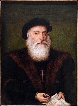
Vasco da Gama took an open sea route from the latitude of Sierra Leone, spending three months in the open sea of the South Atlantic to profit from the southwards deflection of the southwesterly winds on the Brazilian side and the Brazilian current going southward.
Image source: Vasco da Gama
Mar 1500
% complete
Pedro Álvares Cabral, departing March 1500, took an even larger arch to the west from the latitude of Cape Verde, thus avoiding the summer monsoon that would have blocked Vasco da Gama's route at the time he set sail.
Image source: Pedro Álvares Cabral
1502 - 1578
% complete
The work of Pedro Nunes (1502–1578) is remembered in the navigation context for the determination of the loxodromic curve: the shortest course between two points on the surface of a sphere represented onto a two-dimensional map.
Image source: Pedro Nunes
1527
% complete
Pedro Nunes was personally involved in the instruction of pilots and senior seafarers from 1527 onwards by Royal appointment, along with his recognized competence as mathematician and astronomer.
1537
% complete
When he published his Treatise of the Sphere in 1537, mostly a commentated translation of earlier work by others, Pedro Nunes included a treatise on geometrical and astronomic methods of navigation.
1775
% complete
The secrecy involving the Portuguese navigations, with the death penalty for leaking maps and routes, concentrated all sensitive records in the Royal Archives, which were completely destroyed by the Lisbon earthquake of 1775.
Image source: 1755 Lisbon earthquake
1513
% complete
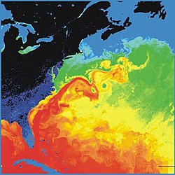
Juan Ponce de León first identified the Gulf Stream in 1513, and although the current was well known to mariners, Benjamin Franklin would later make the first scientific study of it and give it its name.
Image source: Gulf Stream
1761 - 1767
% complete
The Danish expedition to Arabia 1761–67 can be said to be the world's first oceanographic expedition, as the ship Grønland carried scientists including naturalist Peter Forsskål, assigned by King Frederik V to study marine life in the open sea, including finding the cause of mareel, or milky seas.
Image source: Danish Arabia expedition
1766 - 1779
% complete
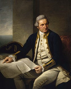
Information on the currents of the Pacific Ocean was gathered by explorers of the late 18th century, including James Cook and Louis Antoine de Bougainville.
Image source: James Cook
1769 - 1770
% complete
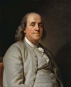
Benjamin Franklin made the first scientific study of the Gulf Stream and gave it its name. Franklin and Timothy Folger printed the first map of the Gulf Stream in 1769–1770.
Image source: Benjamin Franklin
1777
% complete
During a voyage around the Cape of Good Hope in 1777, James Cook mapped 'the banks and currents at the Lagullas', contributing to knowledge of Southern Ocean circulation.
1831 - 1842
% complete
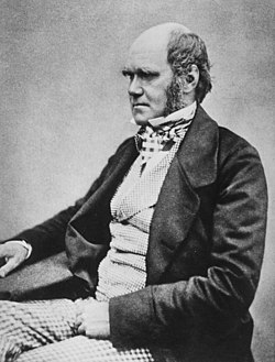
Charles Darwin published a paper on reefs and the formation of atolls as a result of the second voyage of HMS Beagle in 1831–1836, providing an influential theory of coral reef development.
Image source: Charles Darwin
1840
% complete
Sir James Clark Ross took the first modern sounding in deep sea in 1840, marking a milestone in the measurement of ocean depths.
Image source: James Clark Ross
1841 - 1842
% complete
Edward Forbes undertook dredging in the Aegean Sea in 1841–1842 that founded marine ecology, pioneering the scientific study of life on the seafloor.
Image source: Edward Forbes
1842 - 1861
% complete
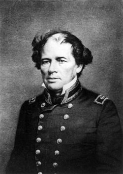
Matthew Fontaine Maury, the first superintendent of the United States Naval Observatory (1842–1861), devoted his time to the study of marine meteorology, navigation, and charting prevailing winds and currents.
Image source: Matthew Fontaine Maury
1850 - 1870
% complete
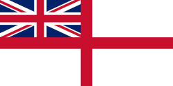
The British Royal Navy's efforts to chart all of the world's coastlines in the mid-19th century reinforced the vague idea that most of the ocean was very deep, although little more was known.
Image source: Royal Navy
1855
% complete
Matthew Fontaine Maury's 1855 textbook Physical Geography of the Sea was one of the first comprehensive oceanography studies, systematizing knowledge of winds, currents, and the sea.
1872 - 1876
% complete
The seminal event in the founding of the modern science of oceanography was the 1872–1876 Challenger expedition. In response to a recommendation from the Royal Society, the British Government announced in 1871 an expedition to explore the world's oceans and conduct appropriate scientific investigation aboard HMS Challenger during the years 1873–76.
Image source: Challenger expedition
1876
% complete
Murray, who supervised publication of the Challenger Report, described it as 'the greatest advance in the knowledge of our planet since the celebrated discoveries of the fifteenth and sixteenth centuries'. He went on to found the academic discipline of oceanography at the University of Edinburgh, which remained the centre for oceanographic research well into the 20th century.
Image source: John Murray (oceanographer)
1881
% complete
In 1881 the geographer John Francon Williams published a seminal book, Geography of the Oceans, helping to establish oceanography as a distinct field of geographic science.
Image source: John Francon Williams
1907 - 1911
% complete
Between 1907 and 1911 Otto Krümmel published the Handbuch der Ozeanographie, which became influential in awakening public interest in oceanography.
Image source: Otto Krümmel
1914
% complete
The first acoustic measurement of sea depth was made in 1914, introducing echo sounding technology that transformed bathymetric mapping of the oceans.
Image source: Echo sounding
1925 - 1927
% complete
Between 1925 and 1927 the Meteor expedition gathered 70,000 ocean depth measurements using an echo sounder, surveying the Mid-Atlantic Ridge and revolutionizing knowledge of the seafloor.
Image source: German Meteor expedition
1934
% complete
In 1934, Easter Ellen Cupp, the first woman to have earned a PhD (at Scripps) in the United States, completed a major work on diatoms that remained the standard taxonomy in the field until well after her death in 1999. In 1940, Cupp was let go from her position at Scripps.
1942
% complete
Sverdrup, Johnson and Fleming published The Oceans in 1942, which was a major landmark synthesizing the state of physical oceanographic knowledge.
Image source: Harald Sverdrup (oceanographer)
1953 - 1954
% complete
The Great Global Rift, running along the Mid-Atlantic Ridge, was discovered by Maurice Ewing and Bruce Heezen in 1953 and mapped by Heezen and Marie Tharp using bathymetric data; in 1954 a mountain range under the Arctic Ocean was found by the Arctic Institute of the USSR.
Image source: Mid-Atlantic Ridge
1958
% complete
The United States nuclear submarine Nautilus made the first journey under the ice to the North Pole in 1958, opening the Arctic Ocean to underwater exploration.
Image source: USS Nautilus (SSN-571)
1960
% complete
The theory of seafloor spreading was developed in 1960 by Harry Hammond Hess, providing a key mechanism for plate tectonics and explaining the youth of the ocean floor.
Image source: Seafloor spreading
1962
% complete
In 1962 the FLIP (Floating Instrument Platform), a 355-foot (108 m) spar buoy, was first deployed, providing a uniquely stable platform for ocean research by flipping to a vertical position at sea.
Image source: RP FLIP
1962 - 1966
% complete
Hill's comprehensive treatise The Sea was published in 1962, while Rhodes Fairbridge's Encyclopedia of Oceanography was published in 1966, consolidating the growing body of oceanographic knowledge.
1966
% complete
The Ocean Drilling Program started in 1966, enabling scientists to recover sediment cores from beneath the deep seafloor and transform understanding of Earth history.
Image source: Ocean Drilling Program
1968
% complete
In 1968, Tanya Atwater led the first all-woman oceanographic expedition, a milestone for women in the marine sciences.
Image source: Tanya Atwater
1971
% complete
Ocean warming accounts for 90% of the energy accumulation associated with global warming since 1971, highlighting the central role of the oceans in Earth's climate system.
Image source: Ocean heat content
1977
% complete
Deep-sea vents were discovered in 1977 by Jack Corliss and Robert Ballard in the submersible DSV Alvin, revealing thriving ecosystems based on chemosynthesis near the Galápagos Rift.
Image source: Hydrothermal vent
1990 - 2002
% complete
1990 saw the start of the World Ocean Circulation Experiment (WOCE), a major international program that continued until 2002 and produced unprecedented observations of global ocean circulation.
1995
% complete
Geosat seafloor mapping data became available in 1995, allowing satellite altimetry to reveal detailed features of the global seafloor topography.
Image source: Geosat
2100
% complete
As a result of ongoing ocean acidification driven by rising atmospheric carbon dioxide, the pH of the ocean is expected to reach 7.7 by the year 2100, posing serious risks to marine ecosystems.
Image source: Ocean acidification
1872
% complete
Marine research institutes began with the Stazione Zoologica Anton Dohrn in Naples, Italy (1872), followed by the Biological Station of Roscoff, France (1876), the Arago Laboratory in Banyuls-sur-mer, France (1882), and the Laboratory of the Marine Biological Association in Plymouth, UK (1884).
Image source: Stazione Zoologica Anton Dohrn
1882
% complete
The first purpose-built oceanographic ship, Albatros, was built in 1882, designed specifically for scientific research at sea rather than being a converted vessel.
Image source: USS Albatross (1882)
1893 - 1896
% complete
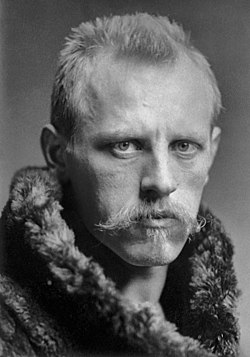
In 1893, Fridtjof Nansen allowed his ship, Fram, to be frozen in the Arctic ice, drifting with the ice pack to study the polar ocean and demonstrating the transpolar drift.
Image source: Fridtjof Nansen
1900
% complete
The Norwegian Institute for Marine Research in Bergen, Norway was established in 1900, followed by the Laboratorium für internationale Meeresforschung in Kiel, Germany in 1902, expanding Europe's network of marine research institutes.
Image source: Norwegian Institute of Marine Research
1902
% complete
The earliest international organizations of oceanography were founded at the turn of the 20th century, starting with the International Council for the Exploration of the Sea created in 1902, followed in 1919 by the Mediterranean Science Commission.
1903
% complete
On the other side of the Atlantic, the Scripps Institution of Oceanography was founded in 1903, becoming one of the leading centers of oceanographic research in the United States.
Image source: Scripps Institution of Oceanography
1910 - 1912
% complete
The four-month 1910 North Atlantic expedition headed by John Murray and Johan Hjort was the most ambitious research oceanographic and marine zoological project ever mounted until then, and led to the classic 1912 book The Depths of the Ocean.
Image source: Ocean Master
1921
% complete
In 1921 the International Hydrographic Bureau, called since 1970 the International Hydrographic Organization, was established to develop hydrographic and nautical charting standards.
Image source: International Hydrographic Organization
1930
% complete
The Woods Hole Oceanographic Institution was founded in 1930, followed by the Virginia Institute of Marine Science in 1938 and the Lamont–Doherty Earth Observatory at Columbia University in 1949, greatly expanding American oceanographic research capacity.
Image source: Woods Hole Oceanographic Institution
1972
% complete
In Australia, the Australian Institute of Marine Science (AIMS), established in 1972, soon became a key player in marine tropical research, particularly on the Great Barrier Reef.
Image source: Australian Institute of Marine Science
Or browse the full history timeline directory, with more than 2,000 topics.
This History of Oceanography timeline was generated with the help of AI, using information found on the internet.
We work hard to keep these timelines accurate, but mistakes do get through. If you spot one, email us at [email protected] and we'll fix it for future visitors.
Generate yours with AI or build it from scratch, for free.
Export your timeline, add your own events, edit or remove AI-generated events, and much more
No credit card required.
Cancel anytime.
Cancel anytime.
You can create an unlimited number of timelines with up to 10 events on each one, customize how they look, export them to PDF, PNG, PowerPoint, CSV, and Excel, and share them with a link. Paid plans raise the event limit and add features like spreadsheet imports and collaborators.
Yes. You can cancel your subscription from your account page at any time, and you will not be charged again. Your subscription stays active for the rest of the period you already paid for.
Yes. We will email you a reminder before the annual renewal, and we will also email you a receipt.
Yes. You can email us within 15 days of any payment, and we will issue you a full refund.
Check out our pricing docs or send us an email anytime: [email protected].