-
Use Cases
-
Resources
-
Pricing
Addis Ababa, meaning 'New Flower' in Amharic, was founded in 1886 by Emperor Menelik II and his wife Empress Taytu Betul. It grew from a hot spring resort into Ethiopia's political and commercial capital. The city has hosted major historical events, including the founding of the Organization of African Unity (OAU) in 1963, survived the Italian occupation (1936–1941), and today serves as the diplomatic capital of Africa, hosting the headquarters of the African Union. More Less
1879
% complete
In 1879, Menelik visited the reputed ruins of a medieval town and an unfinished rock church that showed proof of an Ethiopian presence in the area prior to the campaigns of Ahmad Ibrahim.
Image source: Addis Ababa
1881
% complete
In 1881, Menelik moved the capital of Shewa from Ankober to Entoto, establishing his court on the mountain ridge overlooking what would later become Addis Ababa.
Image source: Ethiopia
Oct 1886
% complete
At the end of the rainy season in 1886, Menelik and Taytu went down to Finfinne along with their retainers and erected a large number of tents.
1887
% complete
In 1887, Taytu left her camp at Entoto and established herself in her new house above the hot springs, marking the beginning of permanent settlement at the site of Addis Ababa.
Image source: Taytu Betul
1889
% complete
In 1889 Negus Menelik expanded his wife's house to become the Imperial Palace, which remains the seat of government in Addis Ababa today.
Image source: Menelik II
1889 - 1891
% complete
Between 1889 and 1891, Addis Ababa became capital of the Ethiopian Empire when Menelik II became Emperor of Ethiopia. After becoming the imperial capital, Addis Ababa grew by leaps and bounds and took on the character of a boomtown.
1891
% complete
The definite building of Addis Ababa began in 1891, when Menelik ordered French engineers to build the very first stone houses.
1896
% complete
After 1896, following Menelik II's victory at Adwa, the city slowly transformed from military encampment to civilian town.
1910
% complete
By 1910, the city had approximately 70,000 permanent inhabitants and also had between 30,000 and 50,000 temporary inhabitants.
1916
% complete
Gebrehiwot Baykedagn started occupying major administrative division posts, ruling as inspector of the Addis Ababa–Djibouti railway in 1916, which connects Addis Ababa with the French Somaliland port of Djibouti.
Image source: Gebrehiwot Baykedagn
1917
% complete
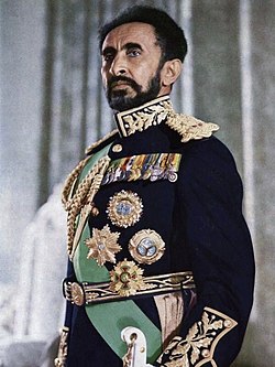
Ras Tafari, later Emperor Haile Selassie, had considerable influence in the city after his appointment as Regent Plenipotentiary in 1917.
Image source: Haile Selassie
1926 - 1927
% complete
By 1926 and 1927, Addis Ababa saw an economic revolution, with a surplus of coffee production growing as a result of capital accumulation.
Image source: Economy of Ethiopia
1926 - 1930
% complete
Total registered automobiles were 76 in 1926, and summed up to 578 by 1930, reflecting the city's rapid modernization.
Image source: Transport in Ethiopia
1927
% complete
Modernization in public health and education led to the erection of schools and hospitals, including a school dedicated to freed slaves founded by Tafari Makonnen in 1927.
1928
% complete
A road was considered the longest continuous motor route, initially connecting Italian-occupied Assab in Eritrea and Addis Ababa via Dessie as accorded in the Italo-Ethiopian Treaty of 1928.
Image source: Italo-Ethiopian Treaty of 1928
Nov 18, 1929
% complete
Significant merchants of Addis Ababa were received by Tafari Mekonnen on 18 November 1929, to deal with road extension.
Dec 1929
% complete
The Emperor's private printing press, the Berhanena Salam Printing Press, was formally opened in December 1929.
Image source: History of Addis Ababa
1946 - 1956
% complete
In 1946, Haile Selassie invited famous British master plan designer Sir Patrick Abercrombie, who wanted to beautify the city as a role model for Africa. Abercrombie achieved a careful plan of major traffic routes, separating neighborhood units, taken from his solution for London's traffic problem in 1943.
Image source: Patrick Abercrombie
1959
% complete
In 1959, British consultant team Bolton Hennessy and Partners commissioned an improvement of Abercrombie's 1954–56 master plan regarding satellite towns.
1960
% complete
The Haile Selassie regime faced backlash—as evidenced by a 1960 coup d'état attempt—from various reactionary partisans.
Image source: 1960 Ethiopian coup attempt
1962
% complete
According to Pankhurst's 1962 survey, 212 square kilometers—58% of total land—were owned by 1,768 persons, owing to 10,000 square meters each, highlighting stark land inequality.
Image source: Richard Pankhurst
1963 - 2002
% complete
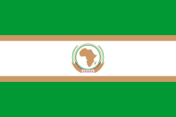
Haile Selassie helped form the Organization of African Unity in 1963 and invited the new organization to keep its headquarters in the city. The OAU was dissolved in 2002 and replaced by the African Union, also headquartered in Addis Ababa.
Image source: Organisation of African Unity
1965
% complete
In 1965, the French Mission for Urban Studies and Habitat led by Luis De Marien prepared a master plan responsible for creating a monumental axis passing through Addis Ababa City Hall through the railway station extending to Gofa Mazoria in the southern part of the city.
1965
% complete
Addis Ababa was the site of the Council of the Oriental Orthodox Churches in 1965, underscoring the city's role as a center of pan-Christian diplomacy.
Image source: Oriental Orthodox Churches
1965
% complete
In 1965, Haile Selassie I University students marched chanting 'Land to the Tiller' in response to the imperial feudal system, culminating in revolutionary protests across Addis Ababa and ushering Marxist–Leninist momentum.
Image source: Ethiopian Student Movement
1935
% complete
Prior to the Italian invasion in 1935, the population of Addis Ababa was estimated to be between 100,000 and 200,000 inhabitants, including 6,000 foreigners, mainly Arabs, Greeks, Armenians and some British, French, Italians and Americans.
Image source: Second Italo-Ethiopian War
1936 - 1941
% complete
Throughout the occupation, trade routes increasingly became spatial growth; Addis Ababa experienced profound road and trade route expansion, opening pavement to Adama and the Ethio-Djibouti trade corridor to the north, Moyale with Kenyan territories to the southwest, and trade routes with Sudan to the west.
1936 - 1941
% complete
Addis Ababa was governed by the Italian Governors of Addis Ababa from 1936 to 1941 during the period of Italian occupation.
Image source: Mayor of Addis Ababa
May 5, 1936 - May 5, 1941
% complete
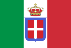
On 5 May 1936, Italian troops occupied Addis Ababa during the Second Italo-Abyssinian War, making it the capital of Italian East Africa.
Image source: Italian East Africa
Jun 1936 - Aug 1936
% complete
The Guildi and Valle's master plan prepared in the summer of 1936 more emphasized fascist ideology and their monumental icons, with no native Ethiopian involvement in the designing sector. Earlier, during a meeting with Mussolini, a French Swiss architect prepared a guideline sketch demonstrating monumental structure traversed by a grand boulevard across the city from north to south, extracted from his Radiant City concept of 1930 to 1933.
May 5, 1941
% complete
After the Italian army in Ethiopia was defeated by the British army (with the help of Arbegnoch) during the liberation of Ethiopia in World War II, Emperor Haile Selassie returned to Addis Ababa on 5 May 1941—five years to the very day after he had departed—and immediately began re-establishing his capital.
Image source: Anglo-Ethiopian Agreement
1973
% complete
In addition to famine and economic hardship, the 1973 oil crisis heavily impacted Addis Ababa, worsening living conditions and fueling unrest.
Image source: 1973 oil crisis
1974
% complete
After the overthrow of Emperor Haile Selassie by the communist Derg in 1974, roughly two-thirds of the housing stock was transferred to rental housing.
Image source: Derg
Feb 1974 - Sep 1974
% complete
Students around the city gathered to protest in February 1974 after Haile Selassie responded dismissively to complaints, stating 'rich and poor have always existed.' Eventually Haile Selassie was deposed from office in 1974 by a group of police officers.
Image source: Ethiopian Revolution
1975
% complete
In 1975, the Derg nationalized all 'extra' rental structures built by private stockholders. Under Proclamation No 47/1975, small buildings went to kebele units, whereas large quality rental houses went to the Agency for Rental Housing Administration (ARHA).
1986 - 1994
% complete
In 1986, a master plan was created by 45 Ethiopian professionals and 75 Italian experts. Despite extensive projections, it was delayed for eight years due to the bureaucratic system of the Derg government and finally approved in 1994.
May 28, 1991
% complete
On 28 May 1991, the Ethiopian People's Revolutionary Democratic Front (EPRDF) coalition party, in the course of overthrowing the Derg government, seized Addis Ababa, marking the end of Marxist rule.
Image source: Fall of the Derg regime
1994 - 1997
% complete
A new constitution was adopted in 1994 and enacted a year later: while all cities in Ethiopia are administrated by regional authority, only Addis Ababa (Proclamation No 87/1997) and Dire Dawa remain chartered cities, mandated for self-governing and development.
Image source: 1995 Constitution of Ethiopia
1998 - 2003
% complete
By the end of 1998, a new project was launched by the Addis Ababa City Administration named the Office for Revision of Addis Ababa Master Plan (ORAAMP), producing the Revised Addis Ababa Master Plan covering 1999 to 2003, similar to the revisited 1986 plan in terms of urban area.
Apr 25, 2014 - Jan 12, 2016
% complete
A master plan for Addis Ababa boundary expansion with 1.1 million hectares into the Oromia special zone sparked violent crackdowns and Oromo-led protests since 25 April 2014. After deadly protests led to numerous casualties in Addis Ababa and Ginchi town, the controversial plan was cancelled on 12 January 2016.
Image source: 2014–2016 Oromo protests
2018
% complete
In 2018, Abiy initiated a project called 'Riverside' planned to expand riverbanks for 56 kilometres (35 mi), from the Entoto Mountains to the Akaki river.
Image source: Abiy Ahmed
2022
% complete
United Nations Population Projections estimated the metro area of Addis Ababa at 5,228,000 in 2022, a 4.43% increase from 2021.
Or browse the full history timeline directory, with more than 2,000 topics.
This History of Addis Ababa timeline was generated with the help of AI, using information found on the internet.
We work hard to keep these timelines accurate, but mistakes do get through. If you spot one, email us at [email protected] and we'll fix it for future visitors.
Generate yours with AI or build it from scratch, for free.
Export your timeline, add your own events, edit or remove AI-generated events, and much more
No credit card required.
Cancel anytime.
Cancel anytime.
You can create an unlimited number of timelines with up to 10 events on each one, customize how they look, export them to PDF, PNG, PowerPoint, CSV, and Excel, and share them with a link. Paid plans raise the event limit and add features like spreadsheet imports and collaborators.
Yes. You can cancel your subscription from your account page at any time, and you will not be charged again. Your subscription stays active for the rest of the period you already paid for.
Yes. We will email you a reminder before the annual renewal, and we will also email you a receipt.
Yes. You can email us within 15 days of any payment, and we will issue you a full refund.
Check out our pricing docs or send us an email anytime: [email protected].