-
Use Cases
-
Resources
-
Pricing
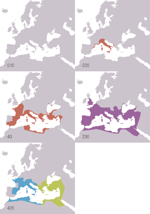
Roman roads were a network of durable, engineered highways built by the Roman Empire to connect its vast territories. Beginning around 312 BC with the Via Appia, these roads enabled rapid military movement, trade, communication, and administration across Europe, North Africa, and the Middle East, leaving a lasting influence on modern infrastructure. More Less
800 BC - 500 BC
% complete
Before Roman road building, the Etruscans and other Italian peoples created rudimentary trackways connecting settlements in central Italy. These early paths, often little more than compacted earth routes, provided the foundation upon which later Roman engineers would build their sophisticated network of paved highways.
Image source: Etruscan civilization
750 BC
% complete
The Via Sacra, the sacred road of Rome, was among the earliest formal streets in the city. Running through the Roman Forum, it connected important religious sites and was used for triumphal processions. It demonstrated the growing importance of organized thoroughfares in early Roman urban planning.
Image source: Via Sacra
312 BC
% complete
Appius Claudius Caecus, censor of Rome, initiated construction of the Via Appia (Appian Way), connecting Rome to Capua. Known as the 'Queen of Roads,' it became the model for Roman road engineering with its durable stone paving, straight alignments, and efficient drainage, revolutionizing travel and military logistics.
Image source: Appian Way
307 BC
% complete
The Via Valeria was built eastward from Rome through the Anio valley toward the Adriatic, reaching the Marsic territories. It opened central Italy's interior to Roman control and commerce, complementing the coastal routes and extending administrative reach into the Apennine highlands.
Image source: Via Valeria
264 BC - 190 BC
% complete
The Via Appia was progressively extended southeastward through Venusia to the Adriatic port of Brindisi. This extension made the road the principal artery for trade and troop movements to Greece and the eastern Mediterranean, cementing its role as Rome's most strategically vital highway.
264 BC - 241 BC
% complete
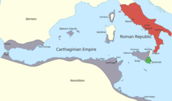
Rome's first overseas war against Carthage required moving legions and supplies across Sicily. The campaign prompted the construction of military roads on the island, marking one of the first times Roman engineering was applied outside Italy and demonstrating how warfare drove infrastructure expansion.
Image source: First Punic War
241 BC
% complete
The Via Aurelia was constructed along the Tyrrhenian coast from Rome to Pisa, later extended into Gaul. Named after the Aurelia family, it served as a crucial coastal route for commerce and military campaigns, linking Rome with Etruria and eventually the western provinces.
Image source: Via Aurelia
220 BC
% complete
Gaius Flaminius, censor of Rome, built the Via Flaminia from Rome to Ariminum (modern Rimini) on the Adriatic coast. Crossing the Apennine Mountains, it became the main route to northern Italy and played a key role in campaigns against the Gauls and later in the civil wars.
Image source: Via Flaminia
218 BC - 201 BC
% complete
During the Second Punic War, Hannibal's march through Italy exposed weaknesses in existing routes but also showed the strategic value of Roman roads. The Via Appia and Via Flaminia enabled rapid Roman troop redeployments, proving that a connected road network was essential to military resilience.
Image source: Second Punic War
218 BC - 19 BC
% complete
As Rome conquered the Iberian Peninsula during and after the Second Punic War, engineers built an extensive road system including the Via Heraclea and routes linking Gades, Tarraco, and Emerita Augusta. These roads integrated Hispania's mineral wealth and agricultural output into the imperial economy.
Image source: Hispania
187 BC
% complete
Consul Marcus Aemilius Lepidus built the Via Aemilia from Ariminum to Placentia (Piacenza) across the Po Valley. The road facilitated colonization of Cisalpine Gaul and stimulated the growth of towns along its path, many of which remain major cities today.
Image source: Via Aemilia
146 BC - 120 BC
% complete
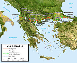
The Via Egnatia was built across Macedonia and Thrace, connecting the Adriatic port of Dyrrachium (Durrës) to Byzantium. It became the primary land link between Rome and the eastern empire, later serving as the route of Paul the Apostle's missionary journeys and crusader armies alike.
Image source: Via Egnatia
125 BC - 50 BC
% complete
Following the conquest of southern Gaul, Romans built the Via Domitia linking Italy to Spain through the province of Gallia Narbonensis. Completed around 118 BC, it was the first Roman road in Gaul and enabled rapid movement of troops and goods between the Italian peninsula and Iberia.
Image source: Gallia Narbonensis
58 BC - 50 BC
% complete
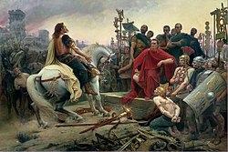
Caesar's conquest of Gaul depended heavily on existing and newly cut roads for supplying eight legions across vast distances. His engineers repaired native routes and built new ones, establishing the pattern of military roads that would later underpin the provincial administration of Gaul.
Image source: Gallic Wars
43 AD - 47 AD
% complete
After the Claudian invasion of Britain, Roman engineers rapidly built a network of straight, cambered roads radiating from Londinium (London) and other centers like Eboracum (York). Watling Street, Ermine Street, and the Fosse Way formed the backbone of the province's administration and military control.
Image source: Roman roads in Britannia
47 AD
% complete
The Fosse Way ran diagonally across Britain from Exeter to Lincoln, roughly following the frontier of the early province. Its remarkable straightness over long distances showcased Roman surveying skill, and it linked numerous forts and later grew into a vital commercial artery.
Image source: Fosse Way
109 AD
% complete
Emperor Trajan constructed the Via Traiana as an improved alternative route of the Via Appia from Beneventum to Brundisium. Built to celebrate his Dacian victories, it reduced travel time to the Adriatic and featured some of the finest engineering of the imperial era, including bridges and viaducts.
Image source: Via Traiana
122 AD - 128 AD
% complete
The construction of Hadrian's Wall across northern Britain was supported by the Stanegate road running parallel to the frontier and a network of access roads to forts and milecastles. This infrastructure allowed rapid troop deployment and supply along the empire's northwestern edge.
Image source: Hadrian's Wall
250 BC
% complete
Romans placed cylindrical stone milestones at intervals of one thousand paces (mille passus) along their roads, recording distances to Rome or nearby cities. The golden milestone (Milliarium Aureum), erected in the Forum by Augustus around 20 BC, symbolically marked the convergence point of all major roads.
Image source: Milliarium Aureum
200 BC - 100 BC
% complete
By the late Republic, Roman engineers had standardized road construction: layers of statumen (base stones), rudus (rubble), nucleus (sand and gravel), and summum dorsum (paving stones). Cambered surfaces drained water efficiently, and standard widths accommodated two-way traffic, creating remarkably durable highways.
Image source: Roman roads
20 BC
% complete
Emperor Augustus formalized the cursus publicus, an imperial courier and transportation service using relay stations along the major roads. Official messengers could cover up to 80 kilometers per day using fresh horses, making government communication faster than anything previously achieved in the ancient world.
Image source: Cursus publicus
64 AD - 68 AD
% complete
After the Great Fire of 64 AD destroyed much of Rome, Nero mandated wider, straighter streets and regulations requiring firebreaks and proper drainage. The reconstruction improved urban road standards within the capital, though narrow alleys persisted in crowded districts.
Image source: Great Fire of Rome
113 AD
% complete
Trajan's Column, commemorating the Dacian Wars, includes reliefs showing Roman soldiers constructing forts, bridges, and roads during campaigns. The monument preserves vivid evidence of how military engineering corps built infrastructure on the move, felling timber and cutting stone to support advancing legions.
Image source: Trajan's Column
300 AD
% complete
The Antonine Itinerary, a register of roads and stations of the Roman Empire, listed routes with distances between stops across the whole empire. Compiled around the turn of the fourth century, it functioned as an official travel guide and demonstrates the sophistication of Roman geographic administration.
Image source: Antonine Itinerary
350 AD
% complete
The Tabula Peutingeriana, a medieval copy of a late Roman roadmap, depicts the road network stretching from Britain to India in a stylized scroll format. It shows cities, way stations, and distances, offering invaluable insight into how Romans conceptualized their vast interconnected world.
Image source: Tabula Peutingeriana
284 AD - 305 AD
% complete
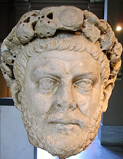
Emperor Diocletian reorganized imperial administration and imposed systematic obligations on provincials to maintain roads and postal stations. His reforms attempted to sustain the aging network amid fiscal strain, codifying the corvée labor systems that kept roads passable in the later empire.
Image source: Diocletian
330 AD
% complete
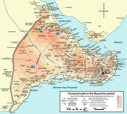
When Constantine dedicated Constantinople as the new capital, the Via Egnatia and routes through Asia Minor were redirected to converge on the city. Constantinople became the eastern terminus of the great road system, anchoring communication between Europe and Asia for centuries.
Image source: Constantinople
400 AD - 476 AD
% complete
In the fifth century, shrinking revenues and barbarian invasions left Western Roman roads increasingly unrepaired. Bridges collapsed and paving deteriorated, though many routes remained usable. The breakdown of centralized maintenance marked the beginning of the network's slow transformation into medieval trackways.
Image source: Fall of the Western Roman Empire
400 AD - 600 AD
% complete
Goths, Franks, Lombards, and other migrating peoples used the surviving Roman roads for their own movements and conquests. Despite the fall of Roman authority, the roads' durability meant they continued to shape migration routes, trade paths, and the location of medieval settlements.
Image source: Migration Period
768 AD - 814 AD
% complete
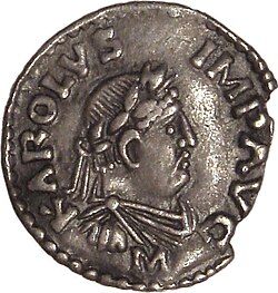
Charlemagne ordered repairs to bridges and roads across his empire, consciously reviving Roman infrastructure traditions. His capitularies instructed counts to maintain public roads and waterways, reflecting how Carolingian rulers saw themselves as heirs to Rome and relied on old Roman routes for administration.
Image source: Charlemagne
1000 AD - 1300 AD
% complete
Throughout the Middle Ages, pilgrims walking to Rome, Santiago de Compostela, and Jerusalem followed routes laid out by Roman engineers, such as the Via Francigena from Canterbury to Rome. The ancient roads thus remained living arteries of European culture long after the empire's fall.
Image source: Via Francigena
1800 AD - 1900 AD
% complete
In the nineteenth century, antiquarians and archaeologists began mapping and excavating Roman roads across Europe and North Africa. Surveys revealed construction details, milestone inscriptions, and route alignments, laying the foundation for modern understanding of Roman engineering and geography.
1920 AD
% complete
Many modern motorways and national highways, such as parts of Italy's autostrade and Britain's A5 along Watling Street, trace the alignments of Roman roads. Engineers rediscovered that the straight, well-drained routes chosen by Roman surveyors remain optimal corridors for transport two millennia later.
Or browse the full history timeline directory, with more than 2,000 topics.
This Roman Roads timeline was generated with the help of AI, using information found on the internet.
We work hard to keep these timelines accurate, but mistakes do get through. If you spot one, email us at [email protected] and we'll fix it for future visitors.
Generate yours with AI or build it from scratch, for free.
Export your timeline, add your own events, edit or remove AI-generated events, and much more
No credit card required.
Cancel anytime.
Cancel anytime.
You can create an unlimited number of timelines with up to 10 events on each one, customize how they look, export them to PDF, PNG, PowerPoint, CSV, and Excel, and share them with a link. Paid plans raise the event limit and add features like spreadsheet imports and collaborators.
Yes. You can cancel your subscription from your account page at any time, and you will not be charged again. Your subscription stays active for the rest of the period you already paid for.
Yes. We will email you a reminder before the annual renewal, and we will also email you a receipt.
Yes. You can email us within 15 days of any payment, and we will issue you a full refund.
Check out our pricing docs or send us an email anytime: [email protected].