-
Use Cases
-
Resources
-
Pricing
The history of navigation traces humanity's efforts to determine position and direction across land and sea. It spans ancient techniques like celestial observation and dead reckoning, medieval advances such as the magnetic compass and astrolabe, the Age of Exploration's breakthroughs in longitude measurement, and modern innovations including radio navigation, radar, and satellite-based GPS. More Less
1500 BC
% complete
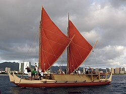
Polynesian navigators began remarkable open-ocean voyages across the Pacific using wayfinding techniques based on stars, wave patterns, cloud formations, and bird flight. Without instruments, they settled islands across thousands of miles of ocean, demonstrating some of the most sophisticated non-instrumental navigation skills in human history.
Image source: Polynesian navigation
1000 BC
% complete
Phoenician sailors became renowned Mediterranean traders who navigated primarily by observing the sun during the day and the North Star at night. Their maritime expertise allowed them to establish trade networks stretching from the Levant to Britain, and they are credited with early circumnavigation-like voyages around Africa.
Image source: Phoenicia
500 BC
% complete
The Carthaginian explorer Hanno led a fleet of ships down the western coast of Africa, possibly reaching as far as modern Senegal or Cameroon. His account, known as the Periplus of Hanno, is one of the earliest written records of exploration and coastal navigation.
325 BC
% complete
The Greek geographer Pytheas sailed from Massalia (Marseille) to Britain and possibly beyond, using a method for determining latitude based on the shadow of a gnomon. He was among the first to describe the midnight sun and to link tides with the moon, advancing scientific understanding of navigation.
Image source: Pytheas
240 BC
% complete
Eratosthenes, chief librarian at Alexandria, calculated Earth's circumference with remarkable accuracy and created one of the first world maps incorporating latitude and longitude concepts. His work provided a geographic framework that later navigators would rely upon for centuries.
Image source: Eratosthenes
150 AD
% complete
Claudius Ptolemy compiled his Geography, cataloguing thousands of locations with latitude and longitude coordinates. Rediscovered in Europe during the Renaissance, his work profoundly influenced mapmaking and navigation, providing the mathematical foundation for later cartographic advances.
Image source: Geography (Ptolemy)
1000
% complete
Norse explorers, following routes from Iceland to Greenland established by Erik the Red, reached North America under Leif Erikson around the year 1000. Viking navigators used sun compasses, sunstones, bird observations, and dead reckoning to cross vast stretches of the North Atlantic centuries before Columbus.
Image source: Vinland
1040
% complete
Chinese texts from the Song dynasty describe magnetized needles used for direction-finding, and by the twelfth century the magnetic compass was being used aboard Chinese ships. This invention would eventually transform oceanic navigation worldwide when it spread through Arab and European maritime trade.
Image source: Compass
1300
% complete
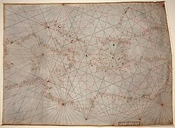
Portolan charts, drawn on parchment with rhumb lines radiating from compass roses, provided remarkably accurate coastal outlines for Mediterranean sailors. Based on compass bearings and estimated distances, these practical navigational tools represented a major advance over earlier symbolic medieval maps.
Image source: Portolan chart
1480
% complete
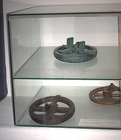
Portuguese sailors adapted the astronomical astrolabe into a simplified brass instrument that could measure the altitude of the sun or stars from a pitching ship's deck. This allowed mariners to determine latitude at sea, making long-distance ocean voyages far more reliable.
Image source: Mariner's astrolabe
1488
% complete
Portuguese navigator Bartolomeu Dias became the first European to round the southern tip of Africa, proving the Atlantic and Indian Oceans were connected. His voyage opened the way for Vasco da Gama's route to India and demonstrated the power of sustained deep-sea navigation.
Image source: Bartolomeu Dias
Aug 3, 1492 - Oct 12, 1492
% complete
Sailing under the Spanish crown, Christopher Columbus crossed the Atlantic using dead reckoning, compass readings, and knowledge of Atlantic winds. His landfall in the Bahamas initiated sustained contact between Europe and the Americas and ushered in an era of transoceanic navigation and exchange.
Image source: Christopher Columbus
1497 - 1499
% complete
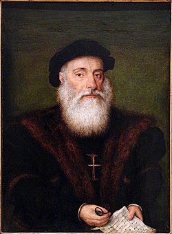
Vasco da Gama commanded the first European voyage to sail directly from Europe to India, rounding Africa and crossing the Indian Ocean with the aid of an Arab pilot, Ahmad ibn Majid. The voyage established the Cape Route and made Portugal a dominant maritime power.
Image source: Vasco da Gama
1519 - 1522
% complete
Ferdinand Magellan's Spanish expedition set out to find a western route to the Spice Islands. Though Magellan died in the Philippines, Juan Sebastián Elcano completed the journey, achieving the first circumnavigation of Earth and proving the planet's oceans were interconnected.
Image source: Magellan expedition
1569
% complete
Gerardus Mercator introduced a cylindrical map projection in which lines of constant bearing appeared as straight lines. This property made the Mercator projection invaluable for marine navigation, as sailors could plot a course with a straightedge and follow a single compass heading.
Image source: Mercator projection
1594
% complete
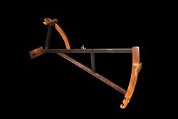
English captain John Davis invented the backstaff, which allowed navigators to measure the sun's altitude without looking directly at it. By facing away from the sun and using its shadow, sailors obtained more accurate latitude readings than with the cross-staff, improving safety at sea.
Image source: Backstaff
1602
% complete
The Dutch East India Company (VOC) became one of the first organizations to systematically train its navigators, requiring examinations and publishing instruction manuals. Its rigorous standards helped professionalize navigation and spread best practices throughout European merchant fleets.
Image source: Dutch East India Company
1675
% complete
King Charles II founded the Royal Observatory at Greenwich specifically to solve the problem of finding longitude at sea. Astronomers there compiled star tables and lunar data, and Greenwich later became the prime meridian and reference point for global timekeeping and navigation.
Image source: Royal Observatory, Greenwich
1701
% complete
Astronomer Edmond Halley conducted dedicated surveying voyages aboard the Paramore to chart magnetic declination across the Atlantic. His published isogonic charts were the first to show how compass variation changed with location, helping navigators correct their compass readings.
Image source: Edmond Halley
1714
% complete
Parliament passed the Longitude Act, offering prizes up to £20,000 for a practical method of determining longitude at sea. The act spurred decades of innovation in both astronomy and horology, ultimately transforming the safety and precision of ocean navigation.
Image source: Longitude Act
1730
% complete
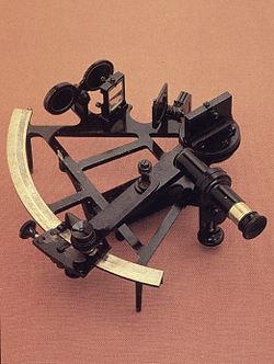
Independently developed by John Hadley and Thomas Godfrey, the sextant used a graduated arc and mirrors to measure angles between celestial bodies and the horizon with great precision. It became the quintessential instrument of celestial navigation, remaining in use well into the twentieth century.
Image source: Sextant
1761
% complete
Clockmaker John Harrison completed the H4, a portable marine chronometer accurate enough to determine longitude by comparing local time with a reference time. After trials to Jamaica, Harrison eventually won recognition, and reliable timekeeping revolutionized navigation by ending reliance on imprecise dead reckoning.
Image source: John Harrison
1767
% complete
The British Nautical Almanac and Astronomical Ephemeris began annual publication, providing precomputed lunar distances and celestial data that allowed navigators to find longitude at sea. It became the authoritative reference for celestial navigation and was widely copied by other nations.
Image source: Nautical almanac
1768 - 1779
% complete
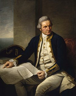
Captain James Cook's three Pacific voyages served as testing grounds for the latest navigational science, including the lunar distance method and marine chronometers. Cook charted coastlines from New Zealand to Alaska with unprecedented accuracy, setting new standards for hydrographic surveying.
Image source: James Cook
1847
% complete
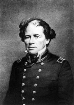
Lieutenant Matthew Fontaine Maury compiled observations from thousands of ship logs into wind and current charts that dramatically shortened voyage times. Known as the Pathfinder of the Seas, he also published The Physical Geography of the Sea, the first comprehensive textbook of oceanography for navigators.
Image source: Matthew Fontaine Maury
1858
% complete
The first working transatlantic telegraph cable connected Europe and North America, requiring precise deep-sea surveying and cable-laying navigation. Although it failed after weeks, subsequent cables transformed maritime communication, allowing ships and shore stations to share weather and navigational warnings.
Image source: Transatlantic telegraph cable
Oct 1884
% complete
Delegates from twenty-five nations met in Washington, D.C., and designated the Greenwich meridian as the prime meridian of the world. This standardized longitude measurement globally, unifying nautical charts and timekeeping systems essential for international navigation.
Image source: International Meridian Conference
1906
% complete
Hermann Anschütz-Kaempfe patented a practical gyrocompass that found true north using a spinning gyroscope rather than magnetism. Unaffected by iron hulls or magnetic interference, it became indispensable aboard steel warships and submarines, complementing the traditional magnetic compass.
Image source: Gyrocompass
1935
% complete
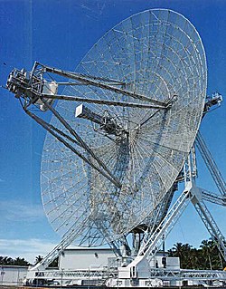
Building on radio-wave experiments by Robert Watson-Watt and others, radar systems capable of detecting distant objects were developed in the years before World War II. Radar transformed navigation and collision avoidance, allowing vessels to operate safely in fog, darkness, and poor visibility.
Image source: Radar
1942
% complete
The Long Range Navigation (LORAN) system, developed during World War II, allowed ships and aircraft to fix their positions by measuring timing differences in low-frequency radio signals from shore stations. LORAN provided all-weather positioning accuracy unprecedented for its era and remained in service for decades.
Image source: LORAN
Apr 1960
% complete
The United States Navy launched Transit 1B, the first operational satellite navigation system. By tracking Doppler shifts in signals from orbiting satellites, submarines and surface ships could fix their positions anywhere on Earth, inaugurating the era of space-based navigation.
Image source: Transit (satellite)
Feb 22, 1978
% complete
The United States launched Navstar 1, the first satellite of what became the Global Positioning System. Once fully operational in 1995, GPS provided continuous, highly accurate positioning worldwide, revolutionizing maritime, aviation, automotive, and personal navigation.
Image source: Global Positioning System
1999
% complete
The European Union committed to building Galileo, an independent global navigation satellite system offering high-precision positioning under civilian control. First services began in 2016, adding redundancy and improved accuracy alongside GPS, GLONASS, and BeiDou for users worldwide.
Image source: Galileo (satellite navigation)
Or browse the full history timeline directory, with more than 2,000 topics.
This History of Navigation timeline was generated with the help of AI, using information found on the internet.
We work hard to keep these timelines accurate, but mistakes do get through. If you spot one, email us at [email protected] and we'll fix it for future visitors.
Generate yours with AI or build it from scratch, for free.
Export your timeline, add your own events, edit or remove AI-generated events, and much more
No credit card required.
Cancel anytime.
Cancel anytime.
You can create an unlimited number of timelines with up to 10 events on each one, customize how they look, export them to PDF, PNG, PowerPoint, CSV, and Excel, and share them with a link. Paid plans raise the event limit and add features like spreadsheet imports and collaborators.
Yes. You can cancel your subscription from your account page at any time, and you will not be charged again. Your subscription stays active for the rest of the period you already paid for.
Yes. We will email you a reminder before the annual renewal, and we will also email you a receipt.
Yes. You can email us within 15 days of any payment, and we will issue you a full refund.
Check out our pricing docs or send us an email anytime: [email protected].